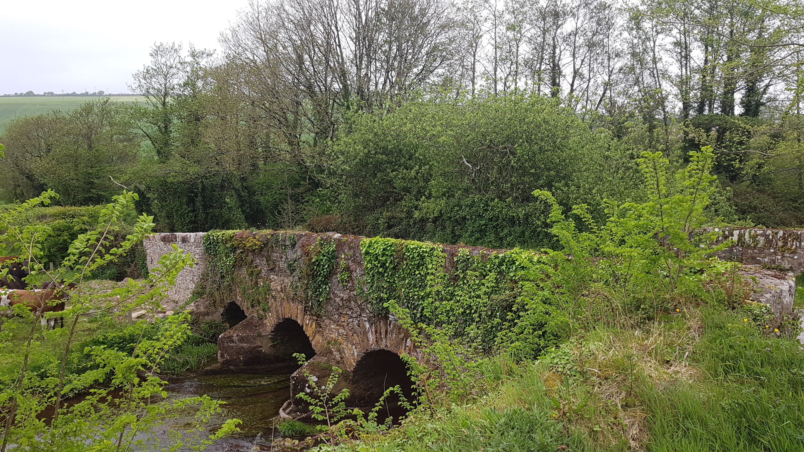
The Two Mile Bridge is a four-arch bridge that spans the Tourig River which forms the boundary between counties Cork and Waterford at this point.
The name of the bridge probably derives from the fact that it is two miles from where the Tourig enters Youghal Harbour. The townland to the north is called Bridgequarter, a placename that dates to 1800. It is likely that this is the oldest stone bridge over the Tourig. It is marked on Taylor & Skinner’s road atlas of Ireland, dated 1777, which does not depict any other river crossing. The Rhincrew Bridge, which spans the Tourig Estuary near the mouth of the river, was not built until around 1870. The bridge may even have been associated with the medieval castles at Kilnatoora, 500 metres to the south-west, or Castlemiles, just over 1km to the north.


Comments about this page
This is a beautiful photo of the bridge Conor.
The Stone Bridge down river from Two Mile Bridge was built in 1819
Add a comment about this page